20,000 Miles
560 Days
23 Countries
3 Continents
an expedition to
![]()
![]()
![]()
![]()
A solo journey by bicycle from Lisbon to Labrador. Starting at the farthest West point of Europe and going to the farthest East point in North America. From the Atlantic ocean in Portugal, the trip will skirt the Mediterranean, Black, and Caspian seas. The route then crosses steep mountain ranges and through the vast open steppes of Central Asia. The most difficult challenge will be heading into the uninhabited reaches of Siberia and Alaska in winter. The path then crosses the interior of Canada before finally ending back on the shores of the Atlantic. An epic human powered journey to connect the people of the world using the power of the bicycle.
Date: June 24th, 2016
Distance: Rest day
I wanted to get out of Osh today, but that didn't happen. I hadn't done anything on my list of stuff to get done. I guess yesterday was too much of a rest day. Today was quite productive, though. I got my website working again. I also visited the bazaar in Osh. I love markets. I should now have the supplies I need to get me to Bishkek.
The other big news of the day is that the UK voted to leave the EU. That is what I have been talking about with Edmund (who is English) and most of the other travelers here. All I can think of is this. Enjoy.
-Dravis
Date: June 23rd, 2016
Distance: Rest day
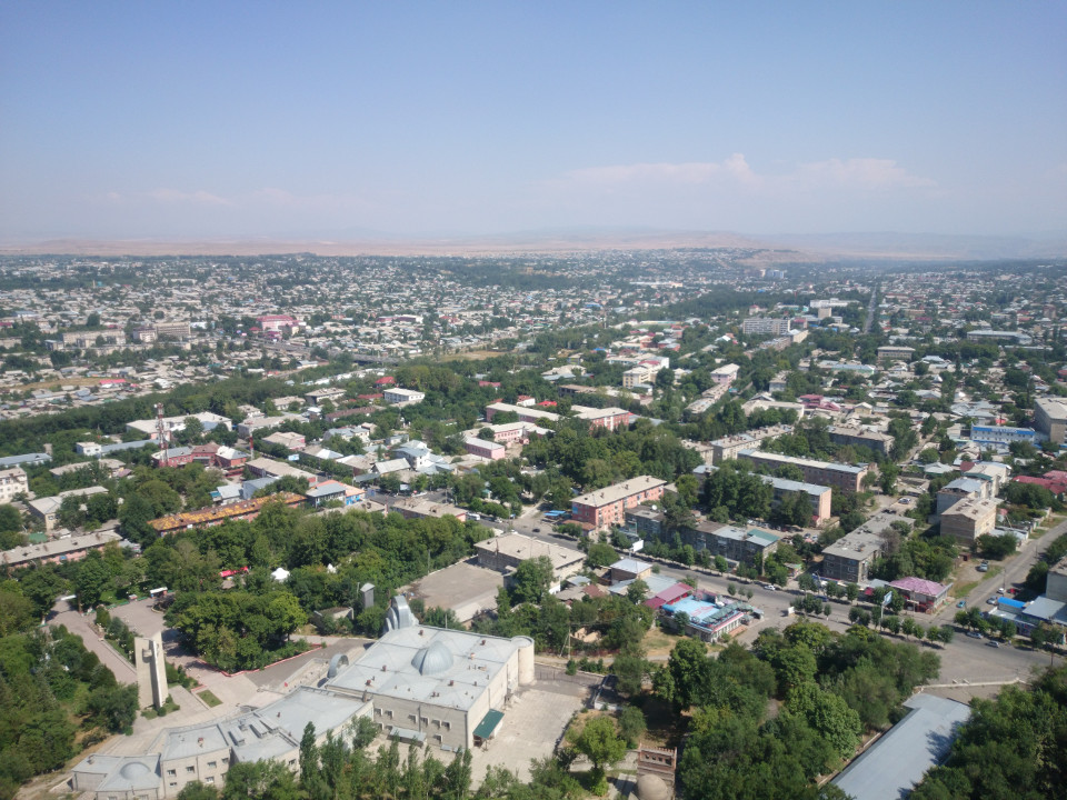 Oh man, this felt great. I had a really good rest day today. I haven't had any time off since Murghab, and that was really much more recovery than rest. Osh is also much more comfortable than Murghab. It's a big city and has things like pizza and hamburgers. It also has internet, which is great after being sort of cut off from the rest of the world.
 -Dravis
Date: June 22nd, 2016
Distance: 84 kilometers
Song of the Day: Revival - The Allman Brothers Band
Edmund was feeling better this morning. This is a good thing, as the first part of the day was a big climb over yet another mountain pass. This one should be the last until Osh, and from the top it's all downhill.
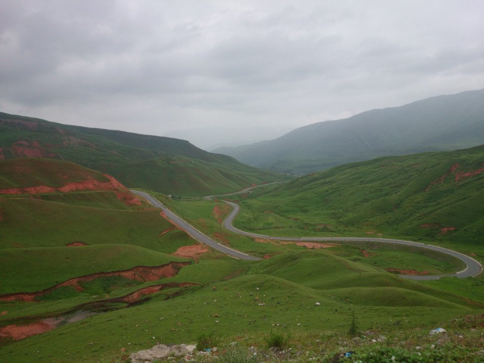 Getting to the top wasn't that hard. It took some time, but the road was well paved and the incline gradual. The landscape was more green grass covering red soil. It probably would have been much more stunning if the day hadn't been so rainy. As it was, the clouds cast a gray pall over everything. It wasn't a bad day, just not as pleasant as doing the same thing under a nice warm sun.
The area at the top of the pass was covered in yurts. I can only guess the Kyrgyz move up here during the summer months to herd their cattle and sheep. I am not used to seeing so many yurts in one place, though. It really is like a village unto itself.
The road from the top was great fun. Nothing too steep, and very few sharp curves. I could just let the bike carry me down the hill. At one point I was riding next to an adolescent boy on a horse. He wanted to race, so I put what power I had into my bike. The boy got his horse to a gallop and we rode that way for a minute or two while the horse slowly pulled away from me. Its hooves kicked up sand and stones in my face. I can't even complain, this is a kind of experience I have never had before. Eventually the boy reined in the horse while I continued on to Osh.
Edmund and I stopped for lunch, which was a mistake. By the time we were done it had begun to rain. The rest of the trip into Osh was a soggy mess. However, we met up with the British couple we had been riding with near Karakul and the four of us headed into Osh together. It was a good trip in spite of the rain and headwind. The downhill grade had us flying.
-Dravis
Date: June 21st, 2016
Distance: 76 kilometers
Song of the Day: Give it Time - Lost Lander
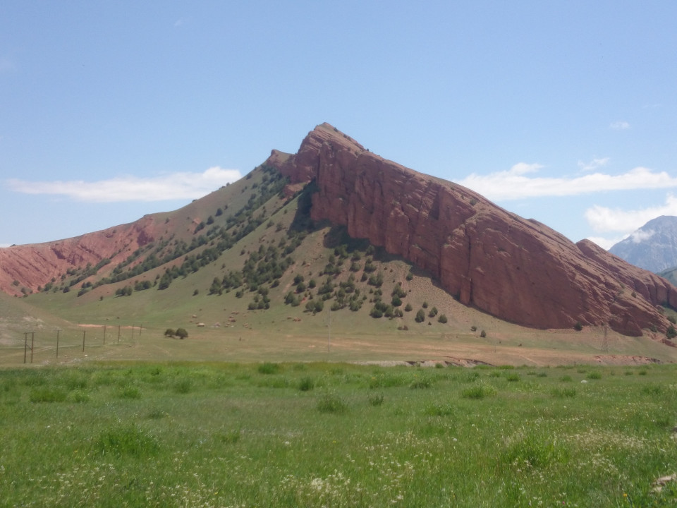 Getting on the road today was slow. I was feeling great, but Edmund was having a hell of a time. He had picked up a bug somewhere and was feeling very ill. I thought he might want to camp out for another day, but he insisted on moving on. In spite of the beauty of the location, we were pretty much out of food. It took quite some time to pack up anyway, and even after we got on the road things weren't fast. The road was almost entirely downhill, as well. I could have sped off, but I really didn't want to leave Edmund in the state he was in. At least going slow gave me a lot of time to enjoy the scenery. Kyrgyzstan continues to be gorgeous.
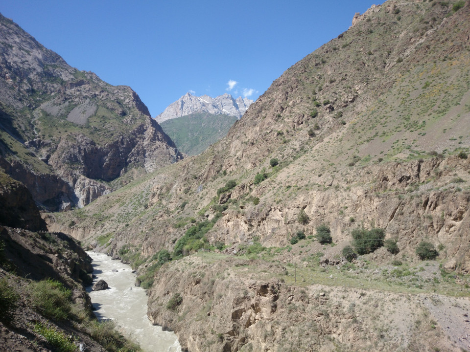
 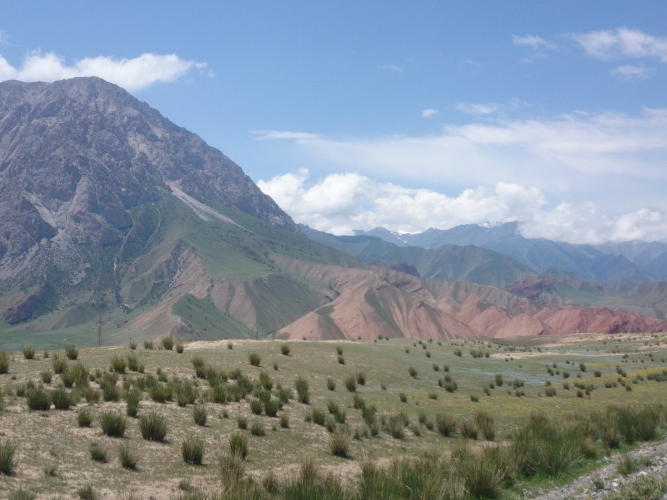 The area we were traveling through was along the Gulcha river. Ever few kilometers the road switched which side of the river it was on, and there was a sign informing you what river you were passing at each bridge. For the early part of the day the river was bounded by hills of red stone. With the green grass and trees creeping up the side of the hills, the blue sky above, it seemed more like a painting than real life. This is one of those places that I had never heard of in my life, but I now feel so lucky to have been able to see.
As the day went on the valley would sometimes spread out. Often a little town would appear in these areas, clinging to the hills above the river. At other times the river would cut a path through a narrow and rocky gorge. The whole place was just a series of beautiful places to be.
 Edmund was still not feeling well, so we made a number of stops to rest. I usually ate some food while Edmund laid down on the ground for a bit. The stops didn't last very long. Invariably we were chased away by an approaching rainstorm. I kept telling Edmund that stopping was a mistake, we either get wind or rain.
 We made it to the town of Gulcha late in the afternoon, and it took a while to find a place to stay. Edmund was more or less a zombie by this point. I didn't blame him, he hadn't eaten very much. I got us checked into a guesthouse and he went right to sleep. I hope he is feeling better tomorrow.
-Dravis
Date: June 20th, 2016
Distance: 78 kilometers
Song of the Day: Life Wasted - Pearl Jam
 The road to the Kyrgyz border post was still a rough dirt track, but it flattened out slowly. The creek next to the road also began to widen. The valley went from a narrow canyon to a wide flood plain tucked between a few rocky hills.
Checking into Kyrgyzstan was the easiest border I have been to since Europe. The country allows visitors to stay up to 60 days without needing a visa. I handed the border officer my passport, he stamped it, and I was on my way. No big deal. Even customs was easy. The official there just asked us if we had cocaine, narcotics, or machine guns. We said no, and were waved through. I wish more borders were this simple.
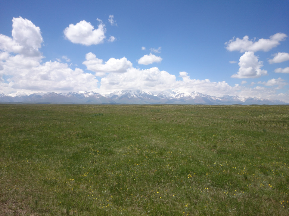 After the checkpoint the road went back to being paved, which was a nice relief. It also left the mountains behind and crossed a wide valley with a slight downhill slope. The ride was just amazing. There were grassy fields on either side of the highway and these fields were sprinkled with wildflowers to add a bit of color. There were also occasionally camps of Yurts. Sometimes solitary, but more often in small groups. I was reminded that the Kyrgyz were a tribe from Mongolia who moved to these mountains a few hundred years ago. They apparently have not lost much of that nomadic lifestyle. If that weren't enough, there were also large hawks circling the area. They are amazing birds. They make flight look so effortless, and yet are so hard to take a picture of.
 We stopped for a quick lunch in Sari Tash. It wasn't much of a town, but the cafe was amazing. Edmund and I were both so hungry we had to order a second helping each.
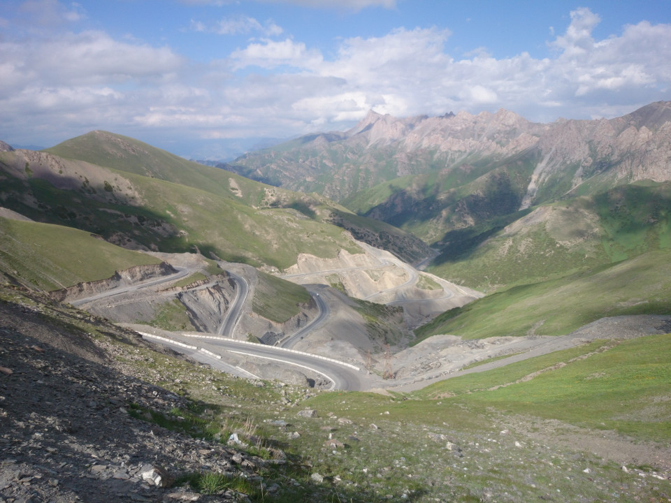 Outside of Sari Tash was another big mountain pass. This meant about an 800 meter climb to the top, with a headwind. It wasn't a bad afternoon, though. The day was warm, but not hot. At the top of the first rise was a little gully and then a second, shorter climb to the second ridge. At the top was a perfect view down the valley. The road below wound down the mountain and into the valley below. All around it were giant granite peaks. It really was a spectacular place. It felt like a road that you only see in movies, a ribbon of pavement zig-zagging through the steep slopes. Riding down it was even more amazing, almost like flying. My bike was working perfectly and I was carving a great line around all of the curves. I was on top of the world, and descending rapidly.
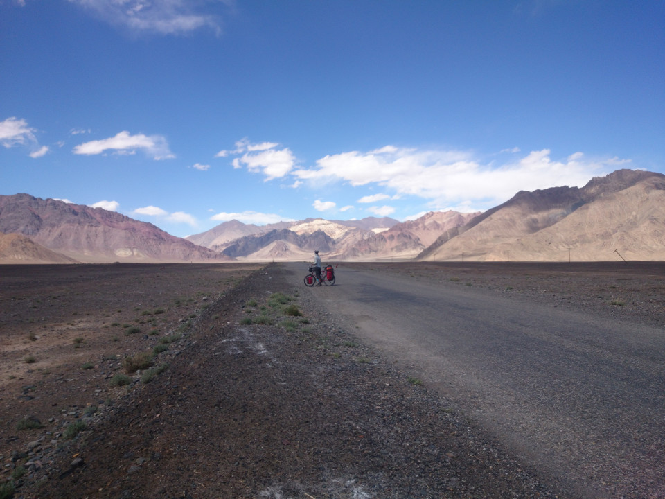
 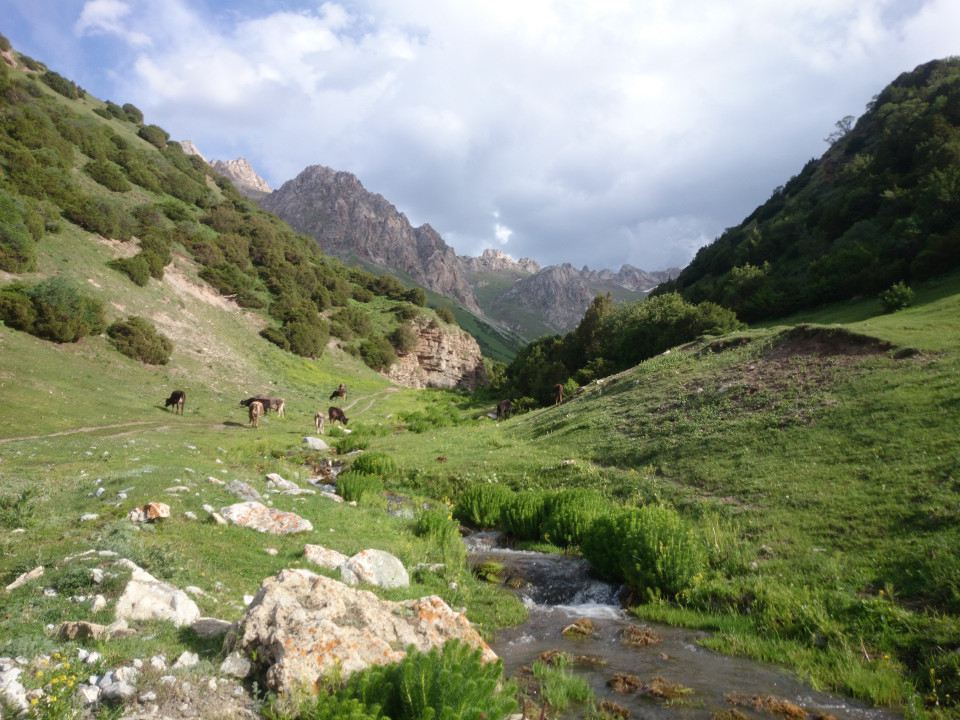 After the switchbacks, the valley slowly widened out and the road became straighter and less steep. The place hadn't lost any of its beauty, though. There were steep hills on either side with mountains behind them. Kyrgyzstan is much more lush and green than Tajikistan was. Where the Pamir plateau had been barren and arid, this valley was full of life. There were trees and plants everywhere, clinging to the steep slopes. There were also so many people here. Tucked into the rocky valleys were various yurts and trailers. It really was a sort of yurt village. The kids who saw us would run out to the road to say "hello" or "bye-bye". The latter appears to be interpreted as a greeting by them.
 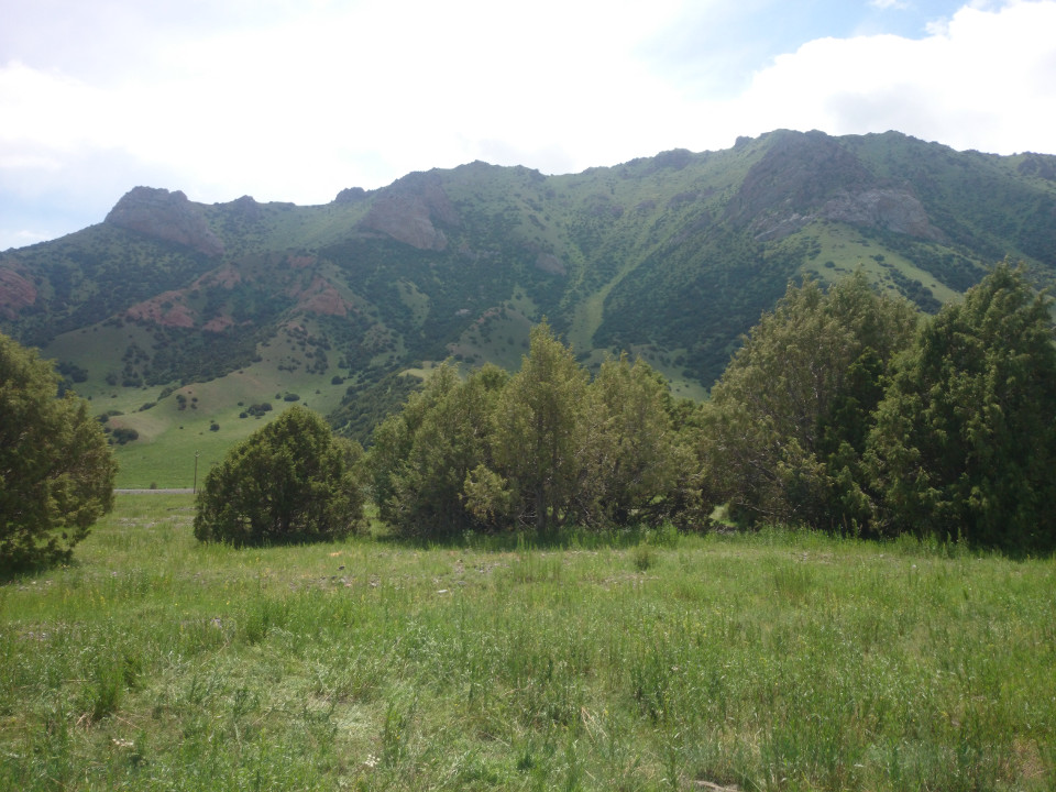 Edmund suggested that we set up camp early and enjoy the scenery. I usually try and ride until sundown, but this seemed like a good idea. It would be nice to have some time to relax. We found a spot in a small grove of trees to shelter us from the wind. I have rarely camped in a spot as beautiful as this. We cooked dinner over a campfire and chatted until well after the stars had come out.
 -Dravis
Date: June 19th, 2016
Distance: 76 kilometers
Song of the Day: All Along the Watchtower - Jimi Hendrix
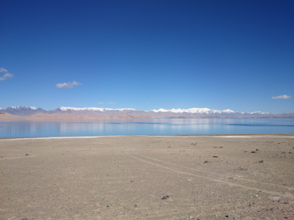 After getting packed up in the morning, Edmund and I made the short dash into the town of Karakul. He had the idea to find somewhere that might cook us a few eggs for breakfast and that seemed like a capital idea to me. The ride into the little village was chilly and beautiful. Karakul lake is a strange and amazing place. It's a sapphire set among the tan of the alpine desert. The wind was gone, so the area had an odd stillness. It's almost hard to believe that anything can live out here. We did come across a heard of yaks grazing on the scrub brush growing along the lake shore, so the area isn't completely devoid of life.
 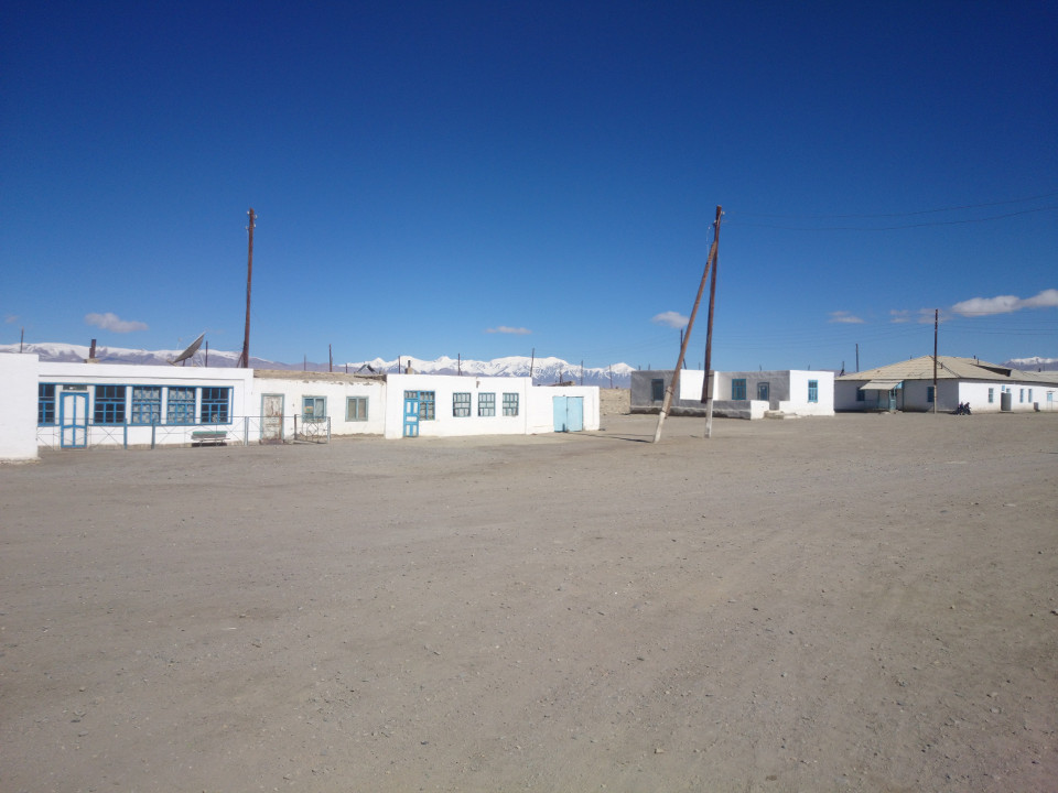 The town of Karakul is about as strange as the land around it. The village consists mostly of mud brick buildings painted white, with an occasional dash of blue. These are all huddled along the Eastern edge of the lake. Karakul just looks like it has been cut off from the rest of the earth. The entire village seems to lack anything from the modern world. In spite of this rustic nature, Edmund and I found a place for breakfast. A simple cafeteria, but they had fried eggs, bread, and tea. Good fuel for spending a day above 4,000 meters. As we left, I was still dumbstruck by the peculiarities of Karakul. It's merely a collection of buildings on the edge of what is habitable, trapped in the mountains and removed from the rest of the world. It was somehow timeless and tragic all at once.
 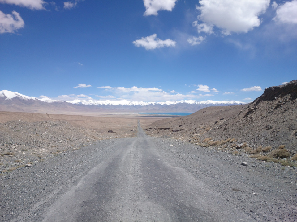 The road from Karakul climbed slowly towards a pair of passes. The first one was just a small obstacle, the second formed the border with Kyrgyzstan. We almost made good time. There was no wind and the road was generally well paved. The big delay was all the other cyclists on the road. We passed a pair of English guys, and a Swiss couple going the other way. There is a certain kind of etiquette among touring cyclists. It's generally good form to stop and chat with other bike riders, share information about the road ahead and things to look out for. Passing another group of cyclists usually takes a few minutes. Not that I mind, it's nice to find people who are out on the road doing what you are doing. Edmund and I also caught up to and rode along with another English couple. It was fun to chat while the gorgeous mountains in the background slid by.
  The four of us stopped for a while near the top of the first pass. (I usually try to eat at or near the top of a climb. The views are better, plus I hate trying to push hard up a hill with a stomach full of food.) While we were eating, the wind picked up, and it only got worse as the afternoon wore on. The wind was really getting to the English couple we were with. They wanted to slow down a bit, so we bid them farewell. Edmund and I pushed ahead into a wind that was now howling. It was whipping dust and sand in our faces. If that weren't bad enough, the pavement ended and the road we were on became terrible again. Another bumpy corduroy road. When it wasn't too sandy we took to riding in the desert on the side of the road.
 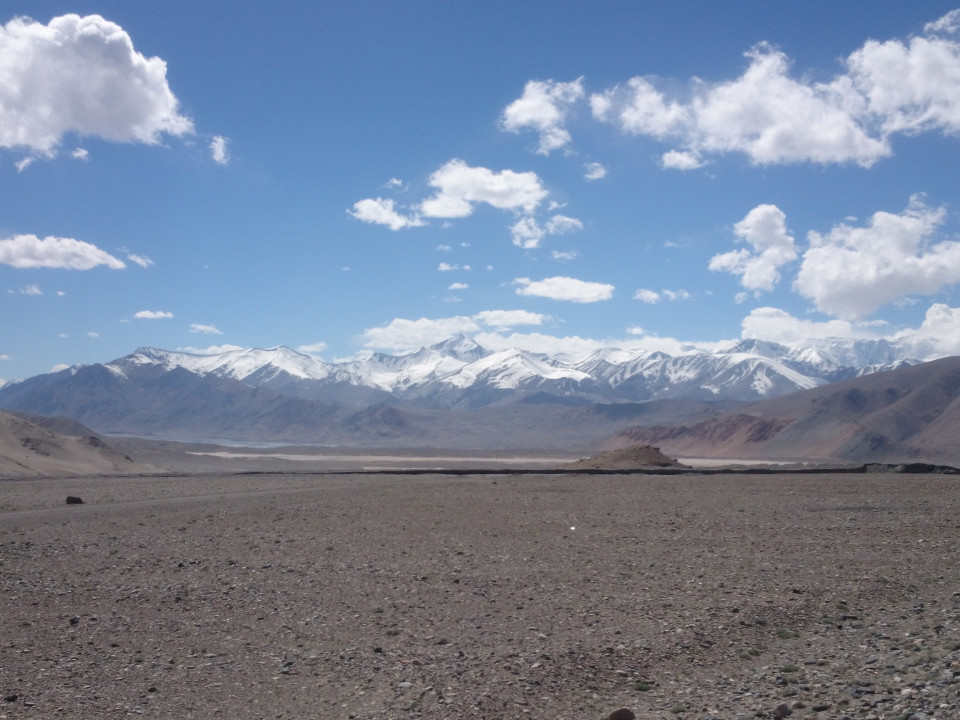 It's too bad, the land around was just fantastic. It still looked like the face of Mars, barren and lifeless. There were major peaks all around, though. Not little ones, either, some towered thousands of meters over us. An impressive feat when the land is already almost 4,000 meters up. It was a crazy place to be. Difficult, rugged, and beautiful. About how I would describe Tajikistan. But I couldn't properly appreciate it because the wind was blowing so much dust in my face.
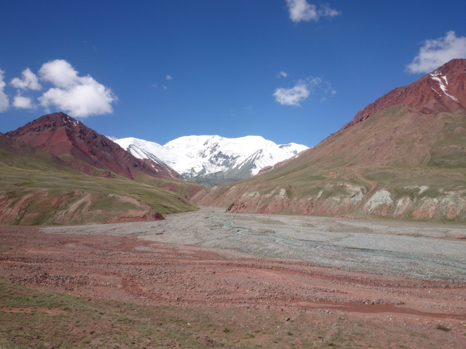
 The road also began a climb out of the small basin we were in. I was worried the dark clouds ahead were bringing in a big storm, but the front only brought in a little sprinkle before being brushed away by the wind. I was still quite relieved when we arrived at the Tajik border post.
 It took a few minutes to get checked through, but eventually we were released into the gap between the borders. Here, that area covers almost 20 kilometers. Now, we could have pushed for the Kyrgyz border post, but would have arrived just at darkness. Instead, Edmund and I opted to camp in between. The first order of business was to get over the pass that marks the border and find a flat spot to camp. The route down on the Kyrgyzstan side was steep, which the road accommodated with a series of switchbacks. It didn't take long before we had dropped 400 meters. The two of us found a small spot to camp along the muddy red creek there.
 -Dravis
Date: June 18th, 2016
Distance: 74 kilometers
Song of the Day: No Ceiling - Eddie Vedder
 Leaving the caravanserai, the road began to get steeper. This was the day of the big pass. Ak Baital is the highest pass on the Pamir highway at 4,655 meters. To put it in perspective, that's higher than any mountain in the continental United States. In fact, if you put the Space Needle on top of Mount Rainier it would still be 250 feet lower than this pass. Boy, did it feel that way, too. It wasn't so much the altitude, though. I'm sure that didn't help much, but after a few weeks I think I've gotten a bit used to the elevation. Really, it was the incline that did it. The road is steep and slow. The last four kilometers are on dirt roads, which don't help. As with most things here, though, you just relax and keep pushing forward. Finding the top felt like conquering the world.
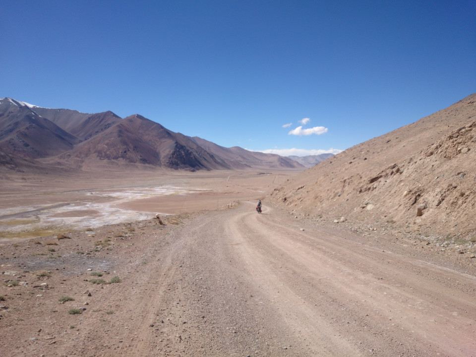 Edmund and I didn't stop very long. The headwind was back and was howling over the pass. In spite of the sun, the air was quite cold. The road on the down slope of the pass was worse than the side we had come up on. Not just dirt, but washboards and gravel. Picking a way down along the steep mountain side was tricky. As the highway leveled off, the road did not improve. On a road like this there is no good path, you just try and pick something that won't rattle your bicycle apart. The road was so bad, in fact, it was often easiest to abandon it all together. The rocky desert on either side was often a better surface for riding on. With the continued wind in our face, this part took hours.
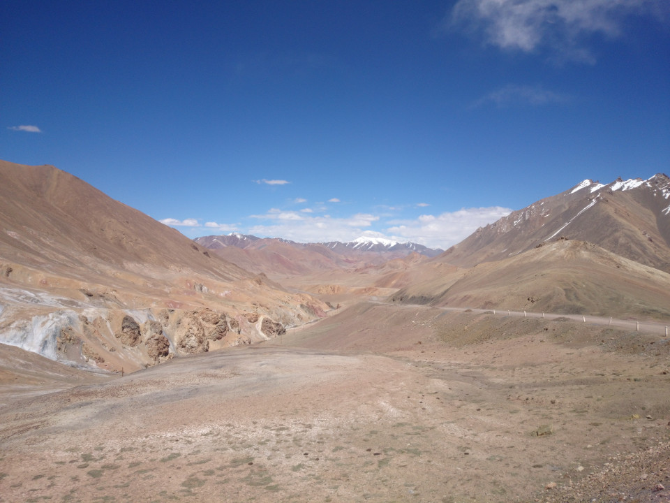
 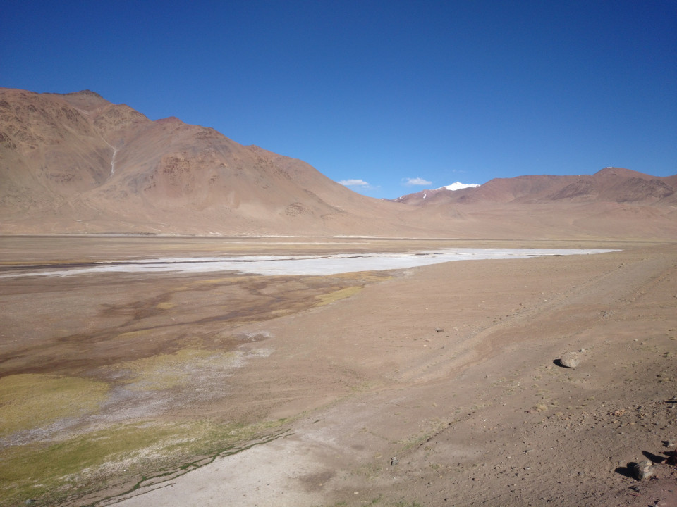 We stopped for a minute at another caravanserai. The layout was different from last night's camp site, but the construction was the same. In the valley below was a small stream and what looked like a glacier. Except the substance wasn't snow, it was salt. A thick white layer, cracked and crumbling. What a strange place. So beautiful, but also so remote and strange.
 Shortly after the stop the road went back to being paved, which was quite a relief to both Edmund and I. The weather hadn't changed, so the better road just meant we were pushing harder into the wind. There was another small pass, but nothing as major as the first one.
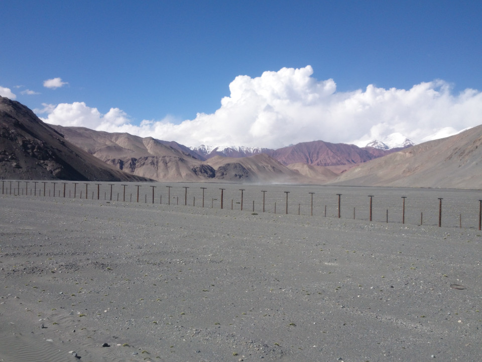
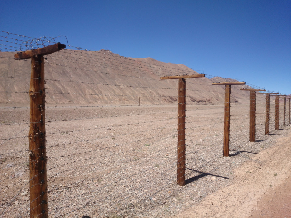 There's an unusual construct here, as well. Just to the east of the road is a long fence. It took a bit to work out what it was all about. The fence seems to be the border with China. Maps show the border much further from the road, probably running along the ridges east of it, and the fence appears to be where China thinks that border should be. It certainly isn't a Tajik effort. The fence is far too regular, Tajikistan just doesn't have the money to build something like that. Plus, the maintenance road is on the Chinese side of it. That said, it's probably a pain to keep the fence in good repair. There are places where it has been washed out by streams or the barbed wire has been cut. The fence couldn't keep goats out, let alone people. Then again, I suppose it's more about claiming land than about security. What a strange place to encroach on, though.
 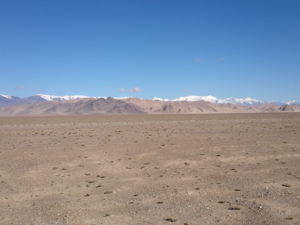 Edmund and I made it to the basin around Karakul Lake as the sun was beginning to set. There are mountains and hills off to either side of the road, but those are kilometers away. Otherwise, it's just a flat and rocky plain. There really isn't anywhere to shelter from the wind. We were in for a spot of luck, though. The wind died away just as darkness fell. That certainly made camping and cooking easier.
 -Dravis
Date: June 17th, 2016
Distance: 50 kilometers
Song of the Day: Overdrive - Foo Fighters
It feels so good to be back on the road after getting sick in Murghab. I feel great, I'm even eating right again. My pneumonia is gone and things are working well for me.
Things got off to a slow start for the day, unfortunately. While we were getting ready in the morning, Edmund noticed that the eyelets where his front rack attaches to his fork were cracked, so he went off to find a welder. I used the opportunity to see the doctor again. He still wasn't happy with me cycling, but he did give me a clean bill of health. Back at the hotel, Edmund was still having problems getting the welds done. Out of three guys he visited, only one had working equipment, and he was at lunch. A long lunch. In the end, we didn't get onto the road until after 2:00 pm.
 Back on the road, though, everything was going well. The road lead slightly up and out of Murghab, but we had a tail wind so it felt like nothing at all. I'm feeling back to my old self, so riding wasn't a problem. I can still feel the affects of the altitude, but it isn't so bad. Really, it just makes you go slower. Edmund and I also kept running into cyclists coming the other way. There were three English girls in one group, and a solo Swiss cyclist. Back in Istanbul I was told this area was a mecca for cyclists, and I can see how true that is now. It's shocking how many people are biking through these mountains.
 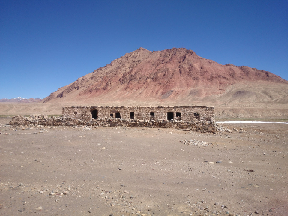 It wasn't long before our great tail wind turned into an annoying headwind. The last 20 kilometers of the day took more time than the first 30. Edmund and I found a cool little place to camp, though. It was an old caravanserai, apparently built in 1899. In spite of being dilapidated, it still functioned as it should, providing us shelter from the biting wind while we were eating and sleeping.
 -Dravis
Date: June 16th, 2016
Distance: Sick day
Still feeling better, but low on energy. I've been eating more and more food, though, so things are improving slowly. I went back to the doctor today for a checkup, and things are well. He was not excited about my plan to bicycle out of Murghab, he would rather I take a taxi. I've come too far to stop riding now, though. I promised to come back one more time before I head out.
I also met up with Edmund, the cyclist I met in Dushanbe and Khorugh. He showed up at the hotel today. I think we are going to head out of town tomorrow. It will be good to have a partner for the last little bit of Tajikistan.
-Dravis
Date: June 15th, 2016
Distance: Sick day
I'm feeling much better today, and the doctors were happy with my progress. I have a lot more energy and my lung is doing better. I'm also coughing and wheezing less. I still feel light-headed walking up stairs and hills, but I can deal with that after a day or two of rest.
-Dravis